While we try and stick to the tried and tested itinerary below, the mountain, the accommodation availability and the weather sometimes has other ideas. We will always remain as flexible as possible to make sure we can change any plans if required.
This is a proposed itinerary and where you stay is subject to change based on how far in advance you book your trip. There is limited availability on this trek so we highly recommend booking in advance.
DAY 1:
Bellevue – Refuge Plan Glacier
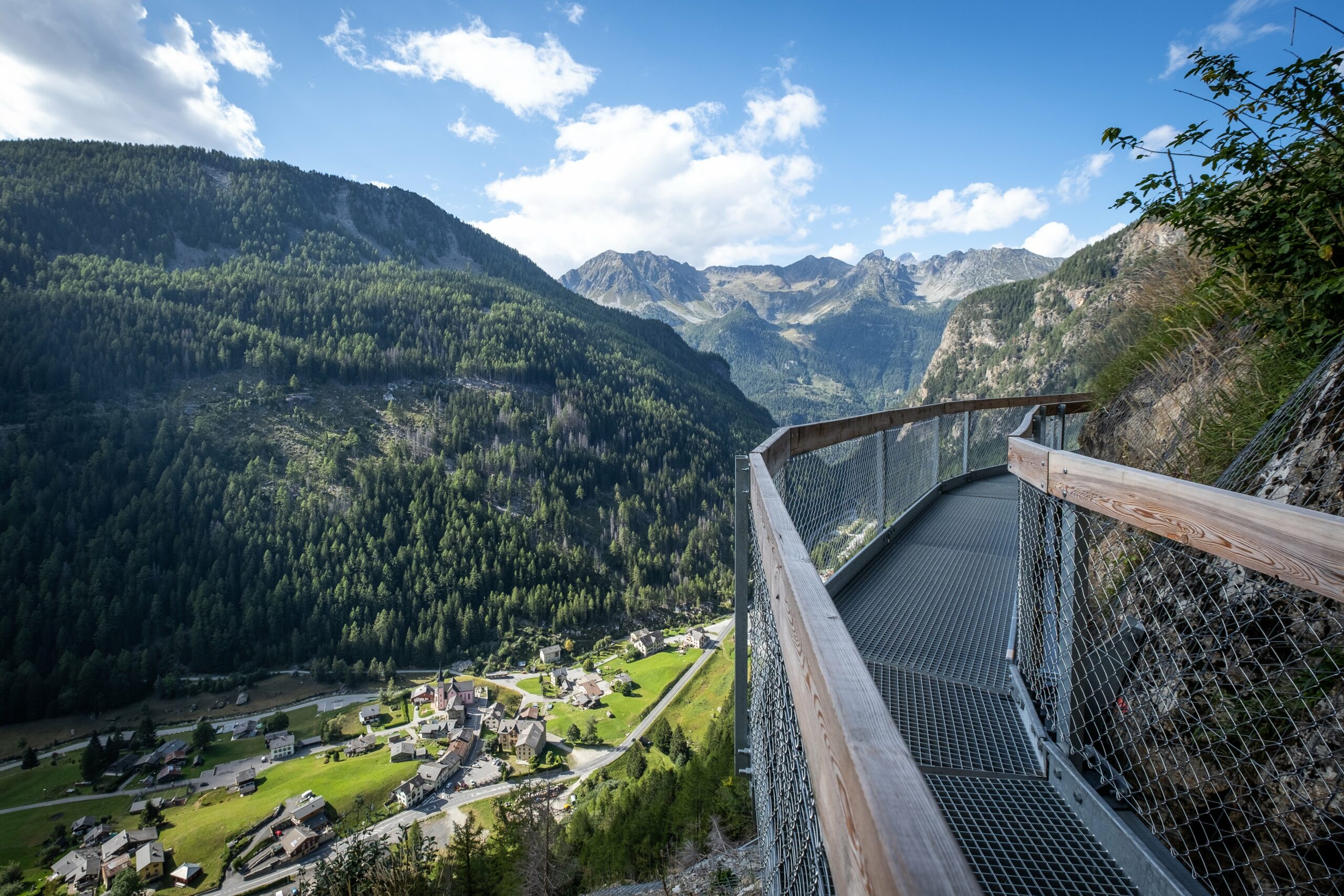
This itinerary takes the Bellevue cable car from Les Houches to the Bellevue Plateau & picks up the path for the Col du Tricot. After the Himalayan suspension bridge the route begins to gently climb until the spectacular Bionnassay glacier comes into full view. From here you can see the top of the Col du Tricot and it’s a steady climb up to the grassy saddle. Spend some time here to admire the views over the Miage Valley and far off the Col du Bonhomme. This is where your true adventure will start. You will not be taking the signposted route descending down from the Col which is where 99% of trekkers will head. If you swivel your head to the left, you’ll see a tiny ribboned balcony path traversing around the mountain side towards an ancient stone archway. This is the old contraband ‘smugglers route’ to Refuge Plan Glacier – it’s unsignposted and leads to most definitely your most adventurous accommodation on the whole of this itinerary. Note: the smugglers route has a large amount of exposure. Trekkers who do not like heights or who are not confident on a narrow path should not choose this itinerary. It takes between two and half & three and a half hours to get to the hut. It’s a further 520m elevation climb. The route has metal railings on the exposure sections and at no point did I personally feel scared skirting around this balcony route. However you MUST not attempt this route in bad weather or indeed too late in the day. Give yourself plenty of time.
9.6km / 950m up / 350m down / 5 – 6 hours trekking
DAY 2:
Refuge Plan Glacier – Refuge Croix du Bonhomme
Wake up to the tranquility of life next to a glacier. Refuel well at breakfast – today you have a long descent down into the Miage Valley and a further two cols to climb this afternoon. The route down to the valley floor is steep along the first ridge line which then peters out as you reach the valley floor. Expect around 2 hours to descend. Grab a coffee as you pass Refuge Miage before a short up and then another long descent into the town of Les Contamines. Our itinerary is planned with the expectation you’ll pick up the free shuttle bus to Notre Dame de la Gorge which leaves regularly in peak season from outside the tourist office. Note: expect to add a further hour to your itinerary if you’re trekking in September – the bus will no longer be running. From Notre Dame de la Gorge its around an hours steep climb up the roman road before passing Refuge Nant Borrant. The climb mellows somewhat up to Refuge de Balme before the real ascent starts to reach the infamous Col du Bonhomme (2329m) and Col de la Croix du Bonhomme (2483m) where early in the season (late June – end of July) you can expect to cross snow. You’ll spend the night in the basic but atmospheric Refuge de la Croix du Bonhomme.
17.8km / 1490m up / 1090m down / 8 – 9 hours trekking
DAY 3:
Refuge Croix du Bonhomme – Elisabetta / Cabane Combal
If the weather is fine take the alternative route just before Refuge de la Croix du Bonhomme via the Col des Fours. This spectacular variant leads you over a lunar like landscape before dropping into the Vallée des Glaciers picking up the trail at Ville des Glacier. Tip: take the 10 minute detour at the top of Col des Fours to the view point Tête des Fours – it is nothing short of spectacular and is the only point on the trek where you can see where you’ve come from and where you’re going to from a birds eye view – oh and the view of the Mont Blanc Massif is nothing short of spectacular as well! I advise stashing your rucksack behind one of the many boulders to simply float up to the view point! Note this route cuts out the hamlet of Les Chapieux. Never attempt this variant route if the weather is nothing short of perfect. If you’re continuing along the normal TMB route the well marked trail will descend all the way to the valley of to Les Chapieux, where you can stop for a welcome refreshment at the friendly Auberge de la Nova. Our itinerary has included transportation from Les Chapieux via the navette (shuttle bus) from the information hut. The navette which costs €3.50 and will ferry you in 20 minutes to Ville des Glaciers from where you can pick up then trail again up to the Col de la Seigne. This high mountain frontière, the French/Italian border, will give you a jaw dropping panoramic of Mont Blanc and the entire Val Veni with it’s dramatic skyline. Descending into the Val Veni you’ll walk along this huge U shape valley passing Refugio Elisabetta (where you might stay) perched on it’s commanding position in front of Glacier d’Estelette and Glacier de la Lée Blanche before continuing along the linear roman road to Cabane Combal. The only hut not at lofty altitude, this hut is nestled in the moraine flank of the Miage glacier.
17.9km / 990m up / 1490m down / 6 – 8 hours trekking
DAY 4:
Elisabetta / Cabane Combal – Rifugio Bertone
Today’s hike takes you up out of the Val Veny floor climbing steadily up to the highest point, a spur from Mont Favre. Looking back you can see the monstrous moraine of Glacier Miage dwarfing Cabane Combal and on a clear day all the way back to Col de la Seigne. From here you’ll trace the contours of the south flank of the Val Veni, following the rise and fall of the mountain side with jaw dropping views of sawtooth peaks and Monte Bianco opposite. From Refugio Maison Vielle during peak season (Aug & Sept) you can opt to take the chair lift and connecting cable car down to Dolonne which is a 10 minute saunter into Courmayeur. We’ve included this chairlift/gondola in the planning of this itinerary (11.8km 5-7hrs) – the descent from Maison Vielle to to the Courmayeur is brutal plus you’ve got another 776m of elevation to climb after lunch to get to your bed for the night at Refuge Bertone (2000m). We highly recommend lunch at Pizzeria Ristorante du Tunnel who serve the largest pizza we’ve ever seen! After a leisurely lunch it’s 4km uphill to your bed for the night at Refugio Bertone.
20km / 1400m up / 1400m down / 7 hours trekking
DAY 5:
Rifugio Bertone – Gite Alpage de la Peule
You’ll be hiking the gentle southern ridge of the Val Ferret valley today before the climb over the Grand Col Ferret (2537m), the border between Italy and Switzerland. Home will be at a working dairy farm, the Gite Alpage de la Peule nestled into the mountain side on the other side of the Col. This itinerary follows the easier route along the contour balcony trail from Refugio Bertone as you’ll be tackling the Grand Col Ferret today as well. For those really wanting to push themselves there is an option to take the Mont de la Saxe high ridge route to Tête de la Tronche which offers insane views of the southern buttress of the Mont Blanc Massif. However, again this route should not be taken in bad weather.
21.5km / 1510m up / 1550m down / 7 – 8 hours trekking
DAY 6:
Gite Alpage de la Peule – Champex
You may be up early this morning. The Alpage de la Peule is an authentic working dairy farm and the cow bells clang at dawn. It’s mostly downhill today. The Swiss section of the TMB is altogether a more mellow landscape with rolling green pastures, pretty meadows and lush forest. You’ll descend into Ferret and then La Fouly. La Fouly sits at the foot of two mighty mountains, Tour Noir (3, 836m) and Mont Dolent (3,823m) which incredibly is the tri-point where all three of the Tour du Mont Blanc countries, France, Switzerland and Italy’s borders meet! The main villages and hamlets of this valley are Ferret, La Fouly, Prayon, Praz de Fort, Les Arlaches, Issert and Som la Proz. All of which you will pass through apart from the last when you will turn uphill for the last 90 minutes to Champex-Lac (pronounced Champay-Lac). The route hugs the left side of the valley, following the west bank of the river La Drance de Ferret and parallel to the main valley road which can easily be heard as your hiking. In wilderness you are not! The best part of today is that you’ll wander through a couple of charming Swiss hamlets. The tiny Les Arlaches with it’s interlaced wooden roofs are a real gem. Before long you’ll start the climb up to Champex-Lac – the only climb of the day. At the top you’ll be rewarded with the beauty of Champex-Lac. Nicknamed ‘Little Canada’ it’s not hard to imagine why – this beautiful lakeside town is surrounded by hills of pine and is genuinely a beautiful spot.
23.8km / 680m up / 1140m down / 7 – 8 hours trekking
DAY 7:
Champex – Refuge Col de Balme
Today is a long day combining two variant stages into one. We must again make you aware that you cannot hike the Col du Fenêtre is the weather is less than perfect. It’s the most technical terrain on the entire TMB and unlike the rest of the trek, the trail is not marked well and can be lost. The boulder field just before the Col requires a lot of attention and trekkers need to be mindful of loose screw and rocks that dislodge easily and can be fatal to trekkers below. Set off super early though and you’ll be in for a treat. When you finally summit the Col you will feel a real sense of achievement – it’s the only place on the trek I’ve experienced other trekkers congratulating each other a real sense of camaraderie. The descent from the Col du Fenêtre is nothing short of astounding. Hairpin bends wind down the rocky descent with the incredible Trient Glacier trailing down beside the trail. This huge hunk of ice will mesmerise you during your descent and will surely be one of your unforgettable memories of this incredible trek. Once you reach the buvette you’ll cross the wooden bridge and start the uphill slog to Refuge Les Grands. The Tibetan style path carved out of the rock will leave you in awe. Stop at the refuge for a cold drink and press on high along hugging the mountain flank until eventually you’ll spot Trient far below and the Trient glacier disappears behind you. You’ll soon see your home for the night – Refuge Col du Balme with it’s iconic red shutters – a tiny dot on the Col du Balme saddle – another frontière marking the boundary between Switzerland and France.
23km / 1830m up / 920m down / 7 – 9 hours trekking
DAY 8:
Refuge Col de Balme – Refuge Lac Blanc / Refuge Flegere
Trekking the north flank of the Chamonix Valley, this itinerary divides stages 10 and 11 of the Tour du Mont Blanc with a detour up to the infamous Lac Blanc. Hiking through the Aiguille Rouge National Park, you’ll have a good chance of seeing marmots, chamois or bouquetin. If you want to complete the entire Les Houches to Les Houches circuit though you’ll need to set off uber early today – it’s a challenging day ending with a knee crunching descent into Les Houches. It may be too much for some and if this is the case there’s the option to take the Plan Praz cable car down to Chamonix centre rather than pressing onto Les Houches. It’s a 2 hours climb up to Lac Blanc for trekkers of your speed. The route climbs steadily until you reach the infamous TMB ladders – a series of 13 ladders and metal ware built into the rock. It’s the most exciting physical aspect of the entire Tour du Mont Blanc. At the Tête aux Vents, a large cairn (2132m) which borders the national park you can choose to detour up to Lac Blanc or traverse along the trail to La Flégère. Lac Blanc (2,352m) has an almost mythical stature. The magic here happens when the day trippers leave late afternoon.
12.2km / 1150m up / 1500m down / 6 – 8 hours trekking
DAY 9:
Refuge Flegere / Refuge Lac Blanc – Chamonix
Today you have a number of exits available to you on the trail. If you need to cut your trip short and leave for home today you can either take the gondola down from La Flégère to the village of Les Praz (10 minute bus ride to central Chamonix) or continue along the balcony route until Plan Praz (8km 3-4 hours) and take the Plan Praz gondola down to central Chamonix. Longer options are taking the Le Brévent cable car up from Plan Praz (17.3km 6-7hrs) and then hiking down to Les Houches, or the longest option (which we would advise against if you want to get into Les Houches during daylight hours is to trek the entire trail to Les Houches (19.8km 8-10 hours or perhaps even longer!) From Refuge Lac Blanc follow the balcony trail past La Flégère and continue to Plan Praz. The entire route along this balcon walk has incredible views of Mont Blanc weather permitting. It truly is astounding. Often it seems like a painted landscape it truly is surreal. Descend via the Plan Praz cable car to Chamonix centre or if you’ve still got energy – you’ve set off early and want to complete the entire circuit from start to finish you’ll need to continue onwards. The best way to do this is to take the cable car UP from Plan Praz to Le Brévent which gives again, insane views of Mont Blanc. The long descent from Le Brévent is hard on the knees but is beautiful with wild red and pink azaleas popping with colour. This area again is known for common sightings of chamois. Expect to fall into Les Houches – this is a huge day but also completing the whole TMB in just 7 days is no easy feat. Well done!
2km – 1 hr / 8km – 3-4hrs / 17.3km 6-7hrs / 19.8km 8-10hrs
