You can see more about this trip here.
Day 1:
Les Houches – Auberge du Truc
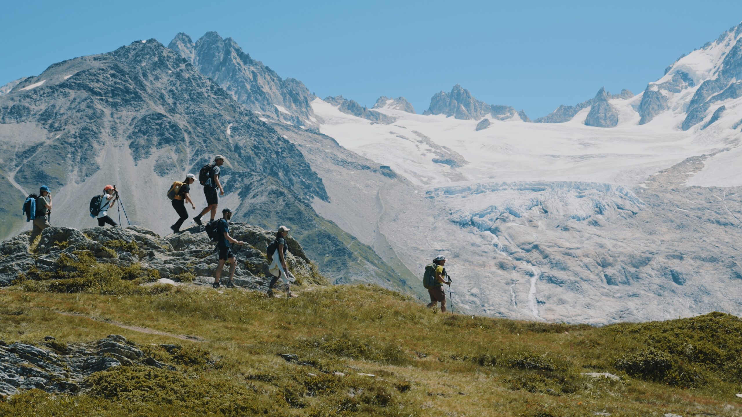
Take the Bellevue cable car in Les Houches up to the Bellevue Plateau. It’s then just a 15 minute walk (very well signposted) to the Col du Voza. Cross the railway tracks and follow the path for Col du Tricot. Crossing the Himalayan suspension bridge is fun for all but especially for kids. After the bridge the route begins to gently climb until the spectacular Bionnassay glacier comes into full view. This is a great spot to have lunch – if you look carefully you’ll see wild bilberry bushes everywhere. From here you can see the top of the Col du Tricot and it’s a steady climb up to the grassy saddle.
Spend some time at the top to admire the views over the Miage Valley and over to the Col du Bonhomme. You can see Refuge Miage far down below in the valley. If you look carefully to your left, you’ll see a stone archway on the ‘smugglers route’ to Refuge Plan Glacier (see our adventure itinerary). Don’t allow your children to explore it as the cliff down in sheer and a fall could well be fatal.
The descent down to Refuge Miage is STEEP! Take it easy and use your poles.
Reaching the valley floor follow the signs to reach Refuge Miage in just 5 minutes. Onwards to Auberge du Truc which is between 45-60 minutes further along the trail. Departing the Refuge Miage you’ll have an initial short climb from the Miage Valley up and over to Auberge du Truc. Just before here on the left is a ‘pointe du navigation’ which shows the names of each of the peaks you can see.
Approximate time and distances:
14.7km / 1445m up / 740m down / 5-6 hours trekking
9.1m / 4740ft up / 2427ft down / 5-6 hours trekking
Day 2:
Auberge du Truc – Val Montjoie
From Auberge du Truc it’s a long steady descent through the forest into Les Contamines. Have a leisurely lunch in this small French town before either choosing to walk along the river to Notre Dame de la Gorge or pick up the free shuttle bus (navette) outside the Tourist Office to Notre Dame de la Gorge where the trail heads out into the wild once more. Take a moment to visit the beautiful Notre Dame de la Gorge chapel next to the gushing water before setting out on the well marked path. Warning – the trail is VERY steep here along an ancient slabbed Roman road to Refuge Nant Borrant but pleasantly flanks the bubbling racing gorge for much of the ascent. Be sure to look out for the pont naturel sign leading to a natural arch on the river, just a minute from the trail. Cross the roman bridge to take in the rushing gorge below. Expect to hike for around just over an hour from the church to reach the refuge.
Approximate time and distances:
8.7km / 316m up / 590m down / 2-3 hours trekking
5.4m / 1036ft up / 1935ft down / 2-3 hours trekking
Day 3:
Val Montjoie – Refuge de la Croix du Bonhomme
Today you’ll make the climb over two mountain passes, Col du Bonhomme (2329m) and Col de la Croix du Bonhomme (2483m) where early in the season (late June – end of July) you can expect to cross snow patches.
You’ll stay in the cavernous Refuge de la Croix du Bonhomme (2433m), a high mountain refuge with epic views. The dorms and private rooms have been renovated to a good standard and we love that dinner is fantastically atmospheric being served in candlelight to save electricity. The food, admittedly, is not the best on the Tour, (especially the soup) but if you soak up the exceptional location, breathe in the grandeur of the mountains, and accept that this is the most adventurous refuge you’ll stay in during this 6 day family TMB trek, you’ll embrace it warts and all.
Approximate time and distances:
8.2km / 990m up / 50m down / 3-4 hours trekking
5m / 615ft up / 165ft down / 3-4 hours trekking
Day 4:
Refuge Bonhomme - Refuge des Mottets
From Refuge de la Croix du Bonhomme it’s pretty much all down hill today. If the weather is fine, and your kids are in good shape after the previous day, consider taking the alternative route from the refuge via the Col des Fours. Experience lunar landscape & rushing waterfalls on this variant route as well as the option of detouring to the Tête Nord des Fours summit – only a further 20 minutes (follow the cairns) which gives one of the best views of the Tour du Mont Blanc – highly recommended. Note: Never attempt this variant route if the weather is nothing short of perfect. The Col des Fours variant bypasses the hamlet of Les Chapieux completely and is actually shorter than taking the traditional route via Les Chapieux however is you want to catch the shuttle bus to ease tired legs if needed, this can only be done from Les Chapieux.
If you’re continuing along the normal TMB route, the well marked trail will descend all the way to the valley of to Les Chapieux where you can stop for a welcome refreshment at the friendly Auberge de la Nova which is more like a hotel (with a great beer garden outside). Then you would need to carry on a further 1.5 hours up the trail to Refuge Les Mottets. This would be the full 11.8km. Or as we would suggest catch the navette (shuttle bus) from Les Chapieux which ferries you in 30 minutes to the parking area of Refuge Les Mottets (you’ll then have to descend down to Refuge Mottets which is a further 5-10 minute descent down on the valley floor. You can choose to get the shuttle bus only as far as Ville des Glaciers – do this is you want to visit the cheese farm – you would then either cross the bridge and walk up the gentle gradient following the TMB trail before descending down the hillside to the Refuge Mottets in the valley bottom or you can walk up the road to the Refuge Mottets parking and then descend down to the refuge. The timetable below (2023) will give you an idea of how often the shuttle bus runs. In 2023 the price was €4 per person with under 12’s going for free.
Approximate time and distances:
11.1km / 340m up / 950m down / 2-3 hours trekking
6.8m / 1115ft up / 3116ft down / 2-3 hours trekking
Day 5:
Refuge des Mottets - Val Veny
Today you’ll say ‘au revoir’ to France and trek over the Col de la Seigne into Italy. Ciao!
From Refuge Les Mottets roll out of bed fresh to tackle the immediate 646m steady climb up the Col de la Seigne up to the French – Italian frontiére. From here Mont Blanc comes fabulously back into view with her surrounding peaks dropping off dramatically into an astonishing deep trough like valley. So spectacular are these jagged peaks that over the next two days you will find it hard to tear your eyes away from the incredible vistas to your left.
It’s an easy descent down from the Col de la Seigne to Refugio Elisabetta, tucked in on a spur between Glacier d’Estellette and Glacier de la Lée Blanche. Your bed for the night will either be here or at Cabane Combal, a further hour along the arrow straight roman road to the highly instagrammable A frame refuge Cabane Combal.
For those staying at Cabane Combal keen for an evening stroll, take the trail behind the refuge to scramble up to the glacier lake, Lac Miage, nestled in the moraine of the Miage Glacier.
Approximate time and distances:
8km / 650m up / 350m down / 2-3 hours trekking
4.9m / 2132ft up / 1148ft down / 2-3 hours trekking
Day 6:
Val Veny - Courmayeur
Your final day trekking takes you up out of the valley floor climbing steadily up to the highest point of the day, a spur from Mont Favre. Looking back you can see the monstrous moraine of Glacier Miage dwarfing Cabane Combal and on a clear day all the way back to Col de la Seigne. From here you’ll trace the contours of the south flank of the Val Veni, following the rise and fall of the mountain side with jaw dropping views of sawtooth peaks and Monte Bianco opposite.
It’s a challenging day and so we highly recommend you to take the chair lift and connecting cable car from Refuge Maison Vielle down to Dolonne, Courmayeur. Our timing has reflected this welcome short cut plus know that the descent is painfully jarring. We would not recommend finishing your day by attempting this with tired children!
Approximate time and distances:
15.7km / 540m up / 1532m down / 5-6 hours trekking
9.7m / 1771ft up / 5026ft down / 5-6 hours trekking
