You can see more about this trip here.
Day 1:
Les Houches - Val Montjoie
This itinerary takes the Bellevue cable car from Les Houches to the Bellevue Plateau & picks up the path for the Col du Tricot. After the Himalayan suspension bridge the route begins to gently climb until the spectacular Bionnassay glacier comes into full view. From here you can see the top of the Col du Tricot and it’s a steady climb up to the grassy saddle. Spend some time here to admire the views over the Miage Valley and far off the Col du Bonhomme. Spot Refuge Miage in the distant cluster of farm buildings way down in the valley below (a great stop refreshment stop if you have time). If you look carefully to your left, you’ll see a stone archway on the ‘smugglers route’ to Refuge Plan Glacier (see our adventure itinerary). The descent down is STEEP! Take it easy and use your poles. Reaching the valley floor follow the signs to reach Refuge Miage in just 5 minutes. This cluster of farm buildings in set in an idyllic rural setting and is charmingly French. The view of the Dômes de Miage (3600m) from the refuge is outstanding.
After an initial short climb from the Miage Valley up and over to Auberge du Truc. From here it’s a long steady descent through the forest into Les Contamines.
Approximate time and distances:
13.6kms / 683m up / 1,307m down / 3-4 hours trekking
8.4miles / 2240ft up / 4286ft down / 3-4 hours trekking
Day 2:
Val Montjoie - Les Chapieux
Today you’ll make the climb over two mountain passes, Col du Bonhomme (2329m) and Col de la Croix du Bonhomme (2483m) where early in the season (late June – end of July) you can expect to cross patches of snow.
Departing from this small French town you can either choose to walk along the river to Notre Dame de la Gorge or pick up the free shuttle bus (navette) outside the Tourist Office to Notre Dame de la Gorge where the trail heads out into the wild once more. Taking the free shuttle bus saves around an hour of walking (July & Aug only).
Take a moment to visit the beautiful Notre Dame de la Gorge chapel next to the gushing water before setting out on the well marked path. Warning – the trail is VERY steep here along an ancient slabbed Roman road to Refuge Nant Borrant but pleasantly flanks the bubbling racing gorge for much of the ascent. Be sure to look out for the pont naturel sign leading to a natural arch on the river, just a minute from the trail. Cross the roman bridge to take in the rushing gorge below. After reaching Refuge Nant Borrant press for almost a further 3kms before reaching Refuge Le Balme. Be sure to stop here for a refreshment as after this you’ll begin the ascent of the Col de la Croix du Bonhomme.
It’s straight up the Col de la Croix du Bonhomme. Throw a stone onto the cairn at Plan de Dame as you pass by to remember a British lady that perished here back in the 1800s. Even if you hit snow here during early season you shouldn’t need to put on microspikes as there’s no exposure however its crucial in early season to put them on at the top of the Col du Bonhomme – you’ll see the section between the two cols is just a traverse with a steep mountain gradient falling away on the right hand side. In early season it’s imperative you put on hiking crampons here. In later summer then this is a glorious undulating path with an easy water crossing just before the Col de la Croix du Bonhomme.
You will then descend down into the hamlet of Les Chapieux for the night (depending on availability you may stay in Refuge Mottets or Base Camp Lodge in Bourg St Maurice)
Approximate time and distances:
18.6kms / 1,363m up / 972m down / 5-6 hours trekking
11.5miles / 4470m up / 3188m down / 5-6 hours trekking
Day 3:
Les Chapieux - Courmayeur
From the valley floor the trail climbs steadily up past Refuge Mottets and up the Col de la Seigne – the border crossing from France into Italy. Here at the top you’ll spot Mont Blanc to your left – pray for good weather! The view into the Val Veny is glorious – this beautiful U shaped valley is just outstanding. The descent is easy enough down to the valley floor – don’t miss stopping at the converted Casermetta hut which is now an environmental centre – its around 15-20 mins from the top of the Col de la Seigne on the Italian side.
After descending down onto the valley floor, you’ll pass Rifugio Elisabetta on a high spur to the left. Continue along the straight roman road passing the lake until you are opposite the gorgeous A frame cabin – Cabane Combal – take a photo – it’s beautiful!
Here you can either carry on straight to cross the bridge and turn right to exit the TMB – its around 50-60 minutes to descend on this road to the village of La Visaille where you can catch a free bus to Courmayeur. Or just after you’re opposite with Cabane Combal, you’ll turn right following the TMB signposts to start stage 4.
Climbing up to the highest point, a spur from Mont Favre, looking back you can see the monstrous moraine of Glacier Miage dwarfing Cabane Combal and on a clear day you can see all the way back to Col de la Seigne. From here you’ll trace the contours of the southern flank of the Val Veny following the rise and fall of the mountain side with jaw dropping views of sawtooth peaks and Monte Bianco opposite all the way along to Rifugio Maison Vielle. It’s here during peak season (July &Aug) that we would recommend you to take the chair lift and connecting cable car down to Dolonne (which is a 10 minute saunter into Courmayeur). The last chairlift descends just after 5pm. If you miss the last chairlift don’t worry it’s not a disaster – Rifugio Maison Vielle can call a taxi for you to pick you up just 30 minutes walk away to where the taxi can drive up – the top of the Val Veny cable car (this cable car won’t be running).
Note: if you were to walk down to Courmayeur from Rifugio Maison Vielle, it would be a further 2 hours descent which would make for a very long day indeed. We do advise taking public transport at the end of today to make this day manageable.
Approximate time and distances: (*there are options to make this day shorter via public transport)
25.2kms / 1,506m up / 1,343m down / 7-8 hours trekking
15.6miles / 4939ft up / 4405ft down / 7-8 hours trekking
Day 4:
Courmayeur - Val Ferret
You’ll tackle all the elevation in the first 2 hours as you steadily leave Courmayeur in the distance striking out for Rifugio Bertone. Upon arrival enjoy a refreshment at this cosy rifugio before deciding whether you’ll follow the traditional balcony trail along to Rifugio Bonatti or whether, in good weather, you want to really push yourself taking the Mont de la Saxe high ridge route to Bonatti. This high route goes via Tête de la Tronche which offers insane views of the southern buttress of the Mont Blanc Massif. Both routes start at Rifugio Bertone and end at Rifugio Bonatti.
Approximate time and distances: (*Option to extend daily distances via variant route)
13.6kms / 996m up / 556m down / 4-5 hours trekking
8.4miles / 3266ft up / 1823ft down / 4-5 hours trekking
Day 5:
Val Ferret – Champex
You’ll be walking along the gentle southern ridge of the Val Ferret valley today before passing the Rifugio Elena which is at the bottom of the climb over the Grand Col Ferret (2537m), the border between Italy and Switzerland. From the Col you then descend gently past the working dairy farm Alpage de la Peule where you can stop for a refreshment or a late lunch at Alpage de la Peule. The Swiss section of the TMB is altogether a more mellow landscape with rolling green pastures, pretty meadows and lush forest. You’ll continue down to La Fouly were you’ll catch the bus to Champex Lac missing out stage 7 of the TMB to arrive at the lovely lake side town of Champex Lac.
Approximate time and distances:
19.3kms / 992m up / 1,416m down / 5-6 hours trekking
11.9miles / 3253ft up / 4644ft down / 5-6 hours trekking
Day 6:
Champex - Trient
Today you have a tough call to make as to which route you take – the traditional ‘bovine’ route or the most challenging variant of the entire TMB – the Col du Fenêtre. The first deciding factor is the weather. It must be excellent weather to consider taking the variant.
Then there’s also the draw of the traditional route – lunch at the L’Alpage du Bovine! This fantastic little buvette is certainly one of the best places to eat on the Tour du Mont Blanc. A local family bring their cows up each summer and cook for trekkers – its one of the most authentic places to experience on the TMB (as well as the cheese farm on stage 3). The traditional trail is still not ‘easy’ – there’s a couple of tough ascents in there totalling around 700m of up before the trail eases down with views over the Rhône Valley – the outline of ugly Martigny muted by glorious rows of grapevines.
Approximate time and distances:
16.7kms / 856m up / 1,052m down / 4-5 hours trekking
10.3miles / 2807ft up / 3450ft down / 4-5 hours trekking
Day 7:
Trient - Montroc
Today you’ll ascend from Trient up the Col du Balme. It’s a gradual climb and not too taxing.
From Refuge Col de Balme perched on the Swiss side, you’ll have a splendid view of the entire Chamonix Valley – well done you’ve almost completed the circuit! You can now see where you set off from down the other end of the valley and Mont Blanc will be ever present with her snowy dome to the left of the valley.
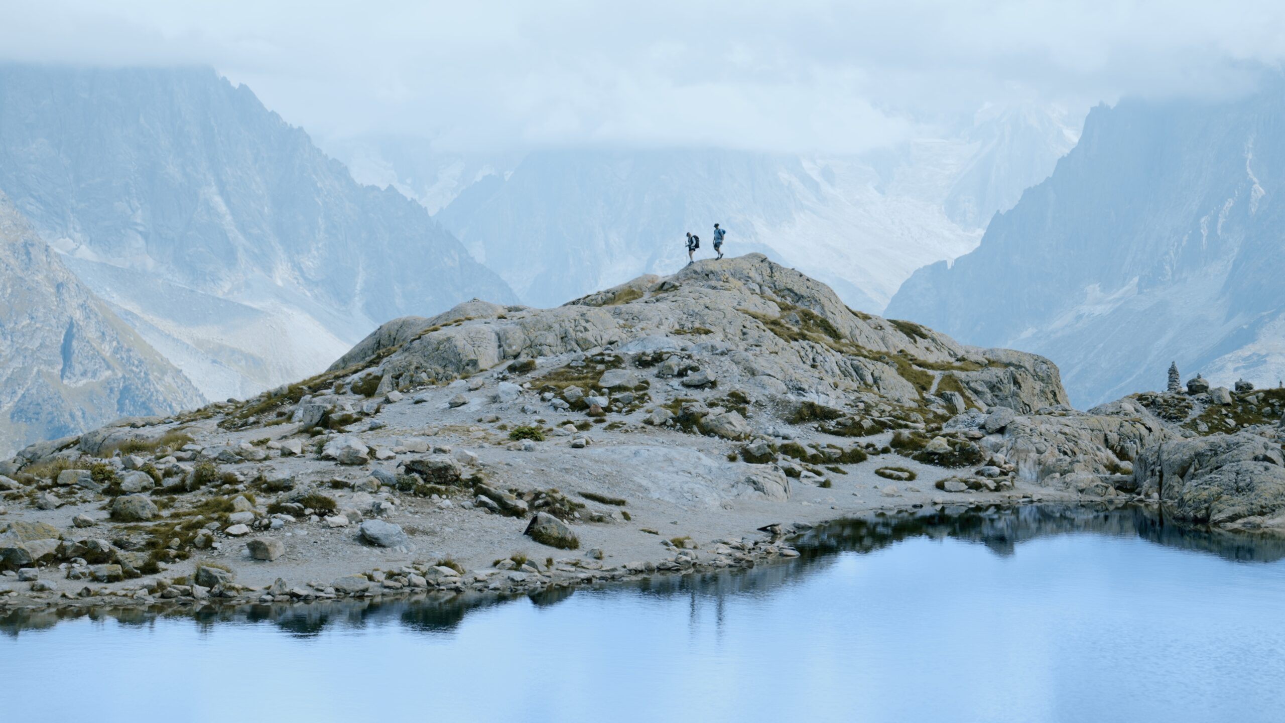
Descend down into France to the saddle of Col des Posettes before ascending the rock spine ridge to L’Aiguillette des Posettes (2201m). L’Aiguillette des Posettes forms the beginning of the impressive northern flank of the Chamonix Valley. In good weather the 360 degree panorama here will take your breath away – the icy dome of Mont Blanc, the iconic spire of the Drus, the Aiguilles Verte as well as Glacier du Tour Lac Blanc and the Lac d’Emosson dam over your shoulder in Switzerland. Bear in mind this high route along the Posette ridge should never be taken in bad weather – the ridge is known for lightning strikes.The descent down to Montroc is brutal. Take your time.
Approximate time and distances:
14.2kms / 1,144m up / 1,046m down / 4-5 hours trekking
8.8miles / 3752ft up / 3430ft down / 4-5 hours trekking
