You can see more about this trip here.
Day 1:
Les Houches - Auberge du Truc
Today is an easy first day to ease into the trek. Ascend on foot up to the Col du Voza and then follow path along parallel to the train tracks to the Bellevue train station where the variant Col du Tricot trail leads down to the right.
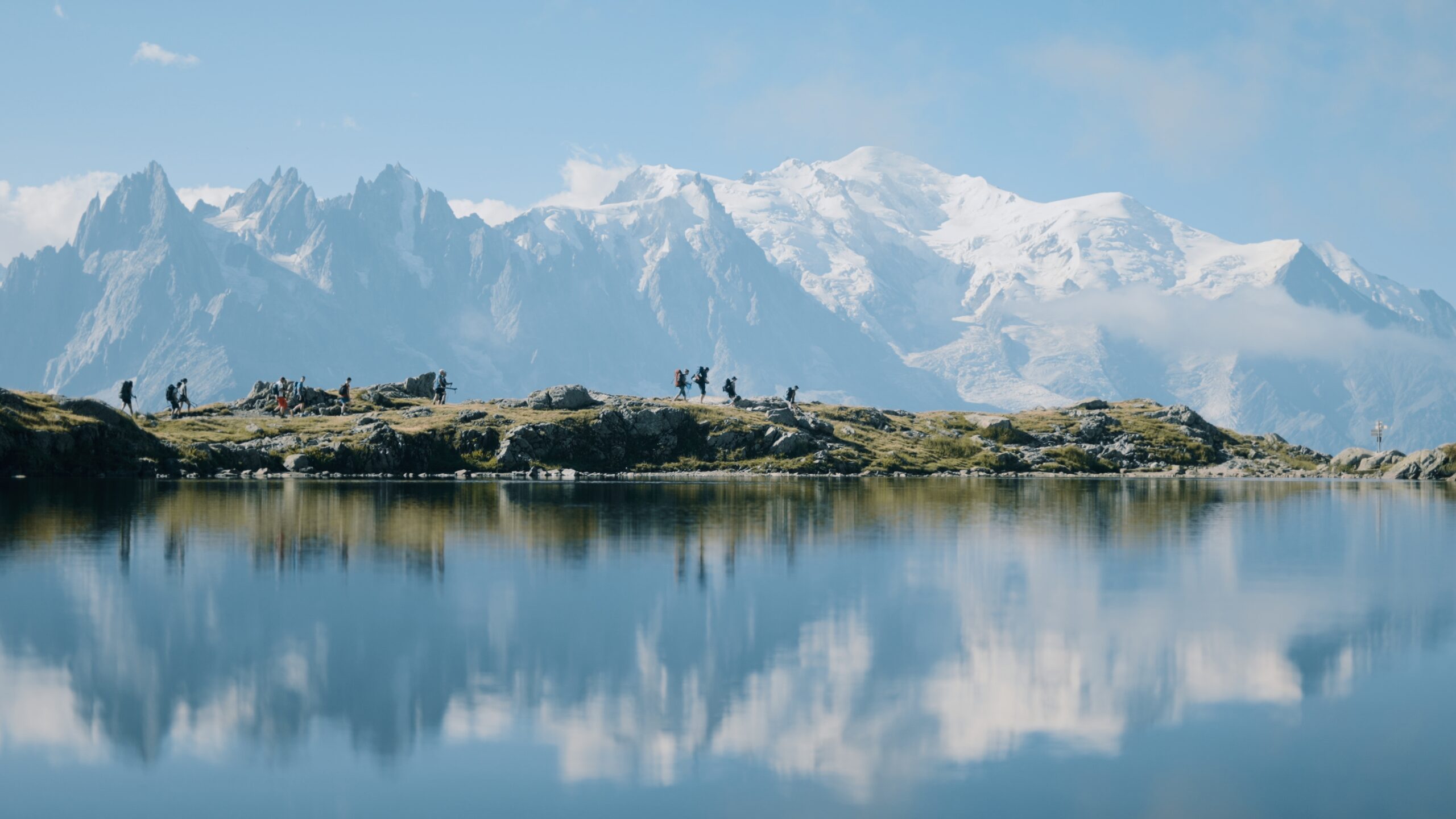
Taking the Bellevue cable car you’ll reach the Bellevue Plateau in minutes. It’s then just a 5 minute walk (very well signposted) to pick up the variant trail. Cross the railway tracks and follow the path for Col du Tricot. After traversing the alpine meadows with views of the spectacular Bionnassay glacier you’ll cross the iconic Himalayan suspension bridge. After a short climb you’ll come to a clearing with several large boulders – the view of the glacier is a good one from here and it’s great spot to have lunch. If you look carefully here you’ll find wild bilberry bushes everywhere.
You can now see the top of the Col du Tricot before you. It’s a steady climb up to the grassy saddle. Spend some time here to admire the views over the Miage Valley and over to the Col du Bonhomme. You can spot Refuge Miage far down in the valley. If you look carefully to your left, you’ll see a stone archway on the ‘smugglers route’ to Refuge Plan Glacier.
The descent down is STEEP and takes around an hour. Take it easy and use your poles. Reaching the valley floor follow the signs to reach Refuge Miage in just 5 minutes. Departing from Refuge Miage you’ll have an initial short climb from the Miage Valley up and over to Auberge du Truc.
Approximate time and distances:
14.7km / 1455m up / 740m down / 5-6 hours trekking
9.1m / 4773ft up / 2427ft down / 5-6 hours trekking
Day 2:
Auberge du Truc - Refuge Bonhomme
From Auberge du Truc it’s a long steady descent through the forest into Les Contamines. Have a leisurely coffee in this small French town before walking along the river to Notre Dame de la Gorge where the trail heads out into the wild once more. If you’re trekking in July or August you can pick up the free shuttle bus (navette) outside the Les Contamines Tourist Office to Notre Dame de la Gorge.
Take a moment to visit the beautiful Notre Dame de la Gorge chapel next to the gushing water before setting out on the well marked path. Warning – the trail is VERY steep here along an ancient slabbed Roman road to Refuge Nant Borrant but pleasantly flanks the bubbling racing gorge for much of the ascent. Be sure to look out for the pont naturel sign leading to a natural arch on the river, just a few minutes from the trail (navigate down a steep, mud track – I normally leave my backpack at the top!). Cross the roman bridge, take in the rushing gorge below. Expect to hike for around an hour from Notre Dame de la Gorge to Refuge Nant Borrant which makes an excellent lunch stop.
This afternoon you’ll make the climb over two mountain passes Col du Bonhomme (2329m) and Col de la Croix du Bonhomme (2483m). You’ll stay in the cavernous Refuge de la Croix du Bonhomme, a high mountain refuge with epic views. This is one of the most remote high mountain huts on the trail so bring your adventure spirit with you. Bunks and storage are excellent & dinner is unforgettable served by candle light to save solar power.
Approximate time and distances:
16.9km / 1361m up / 635m down / 5-6 hours trekking
10.5m / 4465ft up / 2083m down / 5-6 hours trekking
Day 3:
Refuge Bonhomme - Val Veny
Today you’ll descend from Refuge de la Croix du Bonhomme to the hamlet of Les Chapieux and then embark on the steady climb up to the top of the Col de la Seigne – the border between France and Italy! From here, in good weather, you can once again see the gleaming white dome of Mont Blanc with an exceptional view down into this Italian valley.
Dropping down into the Vallée Lee Blanche you’ll marvel at this wide U shaped valley with the fortress of the Mont Blanc Massif dominating to your left. It’s all downhill from here to Refugio Elisabetta – a cavernous refuge perched on a spur just below two glaciers. You’ll either stay at Refugio Elisabetta or 1 hour further in Cabane Combal.
Approximate time and distances:
18.7km / 1032m up / 1288m down / 5-6 hours trekking
11.6m / 3385ft up / 4225ft down / 5-6 hours trekking
Day 4:
Val Veny - Courmayeur
Todays hike takes you up out of the Val Veny floor climbing steadily up to the highest point, a spur from Mont Favre. Looking back you can see the monstrous moraine of Glacier Miage dwarfing Cabane Combal and on a clear day all the way back to Col de la Seigne. From here you’ll trace the contours of the south flank of the Val Veni, following the rise and fall of the mountain side with jaw dropping views of sawtooth peaks and Monte Bianco opposite before descending down into the Italian town of Courmayeur.
From Refugio Maison Vielle during peak season (Aug & Sept) you can opt to take the chair lift and connecting cable car down to Dolonne which is a 10 minute saunter into Courmayeur. The descent from Maison Vielle is brutal so if you’re weary or just want to spend longer in the lovely Italian town of Courmayeur this is definitely a good option.
Approximate time and distances:
15.7km / 540m up / 1532m down / 5.5-7.5 hours trekking
9.7m / 1771ft up / 5026ft down / 5.5 - 7.5 hours trekking
Day 5:
Courmayeur - Val Ferret
Today starts with a push up to the Bertone hut for a late morning Italian coffee. Here, if the weather is good and it’s not early season (14 June – approximately July 7th) you can take the Mont Saxe variant to incorporate an extra peak: it takes a bit longer but it really is a stunning day – not many people, breathtaking scenery and avoids the crowds on the traditional balcony route.
You’ll reach the delightful Rifugio Bonatti hut, where you will either stay (based on availability) or make the easy 30 minute descent down to the valley floor to make your way to the hotel there, or back to Courmayeur for your accommodation.
Approximate time and distances:
12.1km / 1088m up / 263m down / 4-5 hours trekking
7.5m / 3569ft up / 862ft down / 4-5 hours trekking
Day 6:
Val Ferret - La Fouly
Today you’ll climb over the Grand Col Ferret and cross into Switzerland! The gentle Swiss alpine meadows are in stark comparison to the jagged wild landscapes you’ve trekked through in Italy and France. Take it easy as the gentle trail gradually descends to Ferret and the La Fouly.
La Fouly sits at the foot of two mighty mountains, Tour Noir (3, 836m) and Mont Dolent (3,823m) which incredibly is the tri-point where all three of the Tour du Mont Blanc countries, France, Switzerland and Italy’s borders meet!
Approximate time and distances:
18.6km / 907m up / 1331m down / 5.5-7 hours trekking
11.5m / 2975 ft up / 4366ft down / 5.5-7 hours trekking
Day 7:
La Fouly - Champex
Today is the most gentle day of all the TMB stages. There is no col to climb and the route meanders easily through the valley past Swiss mountain pastures. Drink in the delightful scenes of rural life in Switzerland as you potter leisurely along this stage.
Many trekkers actually choose to omit this stage opting to take the bus but for trekkers who are intent to complete the entire route this is a lovely day that your tired legs will be grateful for.
Champex-Lac, your home for the night is a beautiful little town next to a pretty lake. Nicknamed ‘Little Canada’ it’s not hard to imagine why – this beautiful lakeside town is surrounded by hills of pine and is genuinely a beautiful spot.
Approximate time and distances:
14.8km / 578m up / 709m down / 3-4 hours trekking
9.1m / 1896ft up / 2326ft down / 3-4 hours trekking
Day 8:
Champex - Trient
Today you’ll leave the serenity of beautiful Champex-Lac and take the Bovine route to the Col de la Forclaz and then drop down into the Swiss village of Trient, famous for it’s pink church, to spend the night.
The variant route via the Col du Fenêtre can be considered instead of the Bovine route but only in good weather, and only in peak season (not to be attempted in June, possibly in first week of July). Note this route is technically the most difficult on the entire TMB trail – the trail can be hard to follow and crosses a boulder field. It’s a much more difficult route however much more spectacular.
Approximate time and distances:
16.7km / 856m up / 1052m down / 4-5 hours trekking
10.3m / 2808ft up / 3444ft down / 4-5 hours trekking
Day 9:
Trient - Tré le Champ
Today you’ll ascend from Trient up the Col du Balme. It’s a gradual climb and not too taxing.
From Refuge Col de Balme perched on the Swiss side, you’ll have a splendid view of the entire Chamonix Valley – well done you’ve almost completed the circuit! You can now see where you set off from down the other end of the valley and Mont Blanc will be ever present with her snowy dome to the left of the valley.
Descend down into France to the saddle of Col des Posettes before ascending the rock spine ridge to L’Aiguillette des Posettes (2201m). L’Aiguillette des Posettes forms the beginning of the impressive northern flank of the Chamonix Valley. In good weather the 360 degree panorama here will take your breath away – the icy dome of Mont Blanc, the iconic spire of the Drus, the Aiguilles Verte as well as Glacier du Tour Lac Blanc and the Lac d’Emosson dam over your shoulder in Switzerland. Bear in mind this high route along the Posette ridge should never be taken in bad weather – the ridge is known for lightning strikes.
The descent down to Tré-le-Champ is brutal. Take your time.
Approximate time and distances:
15.6kms / 1,151m up / 1,163m down / 5-6 hours trekking
9.6miles / 3775ft up / 3814ft down / 5-6 hours trekking
Day 10:
Tré le Champ - Lac Blanc - Flegere
From here you’ll begin the 3 hours climb up to Lac Blanc. The route climbs steadily for between 1.5-2 hrs until you reach the infamous TMB ladders – a series of 13 ladders and metal ware built into the rock. It’s the most exciting physical aspect of the entire Tour du Mont Blanc – teenagers will love it! This is the Aiguille Rouge National Park so look out for chamois or bouquetin – there’s a good chance of seeing them, often just on the trail.
A further hour up brings you to Tête aux Vents, a large cairn (2132m) which borders the national park. From there you can choose to deviate from the trail and ascend a further 1hr 30 mins to reach stunning Lac Blanc (2,352m) or turn down to follow the trail to Refuge La Flégère, a further 60-90 minutes.
Approximate time and distances:
9.4kms / 1,014m up / 533m down / 3-4 hours trekking
5.8miles / 3325ft up / 1748ft down / 3-4 hours trekking
Day 11:
Flegere - Les Houches
Today you’ll continue along the Balcon Sud with it’s staggering views of Mont Blanc to reach Le Brévent. Choose to take the cable car up to the peak or hike the route that ascends behind that entails a couple of ladder sections. Soak in the magnificent views of Mont Blanc from the top of Le Brévent – undoubtedly the best viewing point of the highest point in Western Europe!
From here you’ll descend on the stony trail along the ridge line to Refuge Bellachat – a great spot for a refreshment with again insane views of Mont Blanc from their lovely sunny terrace. The descent into Les Houches is brutally long – watch those knees! However the pink wild azaleas that line the path are beautiful and there’s a high chance of spotting chamois and bouquetins as you descend.
Approximate time and distances:
17.4km / 811m up / 1682m down / 4-5 hours trekking
10.8m / 2660ft up / 5518ft down / 4-5 hours trekking
