You can see more about this trip here.
Day 1:
Les Houches – Val Montjoie
Starting in the village of Les Houches at the end of Chamonix’s valley, our itinerary starts from the main square where you can take a photo at the official start point arch. If you have stayed over night in Chamonix the night before you’ll need to take the no 1 bus and get off at ‘Les Houches Marie’ stop. After the obligatory arch photo walk 750m along the main road to the Bellevue cable car. Those who want to quick load up to the Bellevue Plateau can do so here. See more info below on taking the Bellevue cable car. Those intent on hiking up from the valley floor) will continue on past Bellevue through the tunnel and turn left onto the main trail up to Col du Voza and follow the signs for TMB variant Col du Tricot.
Soak in incredible views of the Dôme du Gouter and the Aiguille Bionnassay before crossing a raging glacial torrent using the iconic TMB Himalayan suspension bridge. As you begin the relatively easy ascent to grassy saddle of Col du Tricot you’ll have splendid views of the Bionnassay glacier in good weather. Reward the steep descent from the Col du Tricot by booking a table for lunch at Refuge du Miage – a fantastic stop to drink in the impressive views of the Dômes du Miage.
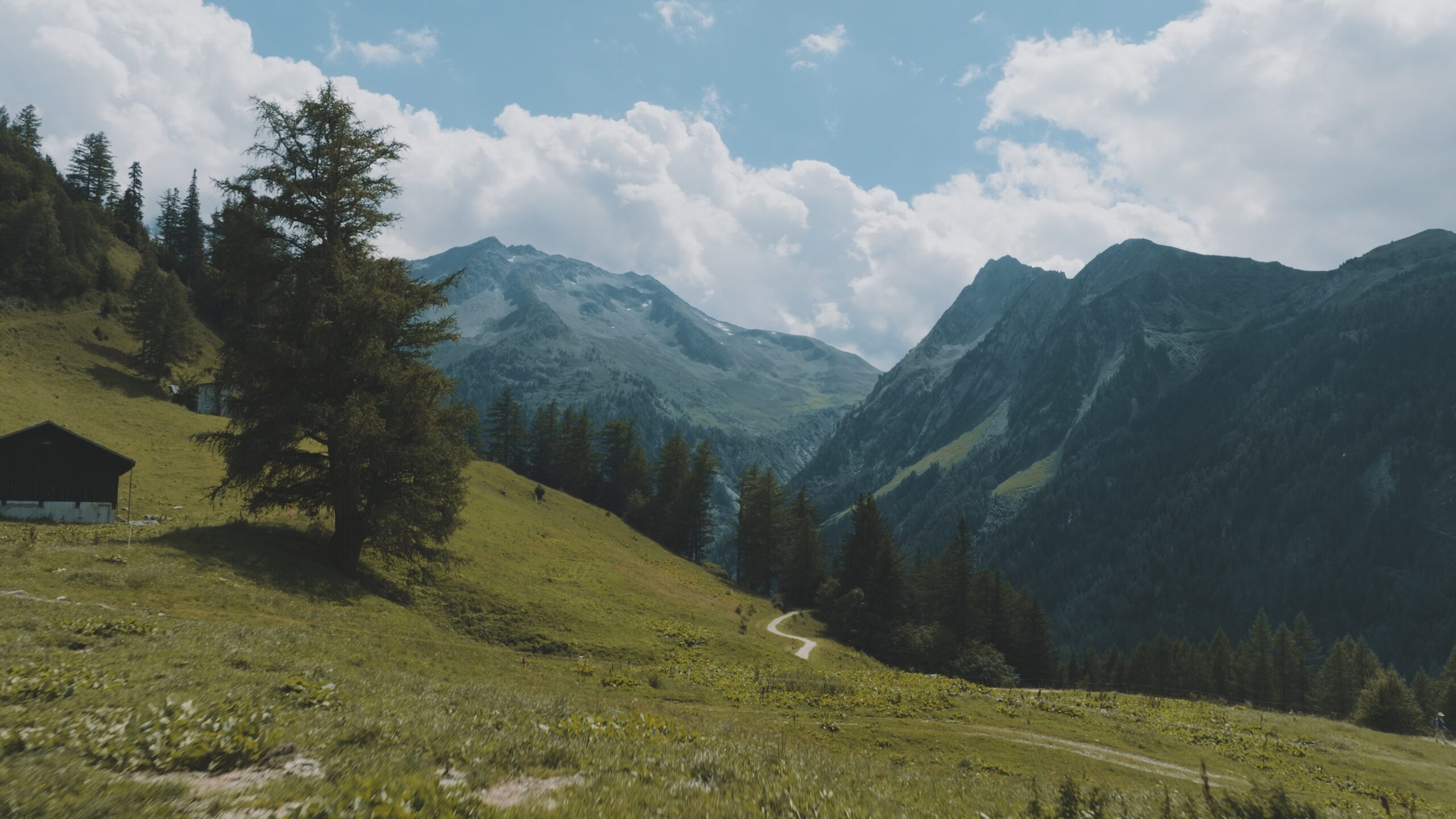
The trail then winds up briefly passing Auberge du Truc (another good lunch spot) before descending to the French town of Les Contamines, traditionally the stop over point for the first stage. Our itinerary either stops here in Les Contamines or pushes on for a further hour on the trail to stop at the first refuge out of Les Contamines, charming Nant Borrant, one of the best refuges on the TMB. By catching the free navette to Gorge du Notre Dame and then climbing the steep hill up to the refuge, you’ll an hour’s head start on a challenging day tomorrow – tackling two cols in one day.
Approximate time and distances:
21.9km / 1754m up / 1240m down / 5-7 hours trekking
13.6m / 5754ft up / 4068ft down / 5-7 hours trekking
Day 2:
Val Montjoie – Les Chapieux
Today is a long, strenuous day which is duly rewarded with incredible views over wild desolate cols. This is truly les Alpes sauvages and your heart will sing to be far from civilisation. Stage 2 of the TMB climbs over two mountain passes Col du Bonhomme (2329m) and Col de la Croix de Bonhomme (2483m), possibly still laden with snow, before descending into the French hamlet of Les Chapieux (1554m) in the Vallée des Glaciers.
Approximate time and distances:
13.4km / 990m up / 920m down / 4-5 hours trekking
8.3 / 3248ft up / 3018 ft down / 4-5 hours trekking
Day 3:
Les Chapieux - Val Veny
Today you’ll switch from Bonjour to Ciao as you climb the Col de la Seigne and walk over the frontiere into Italy. For those who want to shorten todays hike take one of the frequent shuttle buses from Les Chapieux along the tarmac road to La Ville des Glaciers or Les Mottets Parking cutting an hour off the traditional time. Tip: buy your ticket the night before if you want to bag a seat on the first bus at 8.30am otherwise you might have to wait until 9 or 9.30 to get a seat.
At Ville des Glaciers make a quick side trip to the cheese farm only a few metres from the trail. This is one of the most authentic experiences on the TMB and highly recommended. Being a micro producer of the local Beaufort cheese its tiny operation only takes around 15 minutes to look around.
From here the trail ascends to 2516m to the top of the Col de la Seigne and, leaving the Vallée des Glaciers and France behind, cross the unmanned border and descend into Italy!
From the col it’s an easy downhill onto the wide, flat valley floor of Vallon de la Lée Blanche. From here Refuge Elisabetta or Cabane Combal will be your home for the night.
Approximate time and distances:
13.9km / 990m up / 400m down / 4-5 hours trekking
8.6m / 3248ft up / 1312ft down / 4-5 hours trekking
Day 4:
Val Veny - Courmayeur
There are no cols to climb on stage 4 of the Tour du Mont Blanc, so it’s easy to presume that this stretch is not demanding. Think again. However this stage is one of my favourites hands down. The formidable wall of rock holding up the Mont Blanc Massif on the opposite side of the valley highlights our minuscule selves. Prepare to feel humbled.
The trail climbs up the side of the V shaped, moat like Val Veni to the highest point of the day, the Mont Favre spur (2430m). With every step along the high balcony path, the sheer southern flanks of the imposing Mont Blanc Massif range rising on the opposite side, take your breath away. Whilst not particularly challenging, the deceiving nature of this balcony trail leads to you believe you’re almost there. Many times.
It’s a long day that should not be under estimated.
Enjoy a well deserved gelato in the pretty Italian town of Courmayeur. Those wanting a bit of pampering and luxury can choose from several high end hotels. The spa nearby at Pre St Didier is fabulous.
Approximate time and distances:
15.7km / 490m up / 1550m down / 4-5 hours trekking
9.7m / 1607ft up / 5085ft down / 4-5 hours trekking
