You can see more about this trip here.
Day 1:
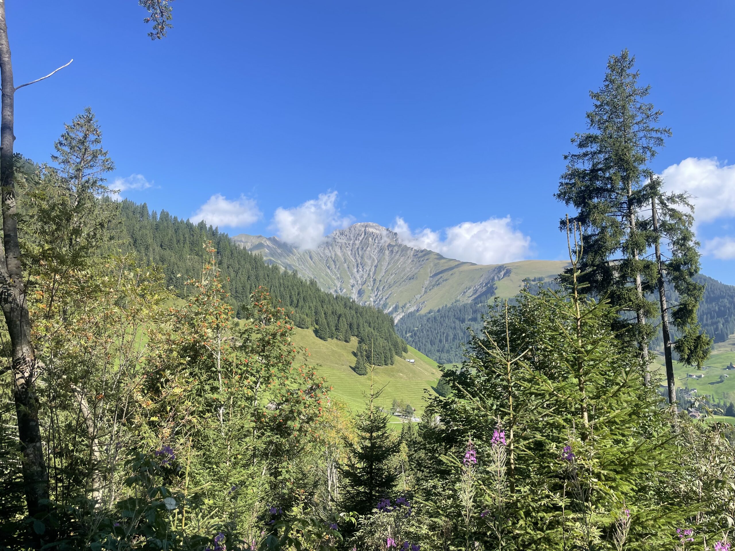
Meiringen - Schwarzwaldalp
Option 1: Hike from Meiringen village → Schwarzwaldalp (10kms / 1000m up / 150m down)
Option 2 (Recommended): Take the funicular to Reichenbach Falls → Hike to Schwarzwaldalp (7.5kms / 750m up / 150m down)
Option 3: Take the bus to Schwarzwaldalp (skip the first day’s hiking)
Optional side adventures:
* Sherlock Holmes Museum, Meiringen
* Reichenbach Falls Funicular
* Rosenlaui Glacier Gorge
* Schwarzwaldalp Sawmill
Option 1:
For those who want to complete the trek entirely on foot, the trail starts in Meiringen and follows the left side of the Reichenbach Falls up to Zwirgi.
Option 2:
Ride the funicular railway to the Reichenbach Falls, a series of seven cascades dropping a total of 300 meters. The Upper Reichenbach, at 120 meters, is the tallest. The falls are also the famous setting of Conan Doyle’s The Final Problem (1893), where Sherlock Holmes and Professor Moriarty face their dramatic final confrontation.
Options 1 & 2 join at Zwirgi. From here, the route climbs steadily through the forest, weaving along a path beside the road toward Schwarzwaldalp. The landscape opens at the Gschwantenmad, where the Rosenlaui Glacier rises above and the Wellhorn and Wetterhorn dominate the skyline, while a stream cuts through open meadows. At the valley entrance, you will find the historic Rosenlaui Hotel and the Glacier Gorge.
The Rosenlaui Glacier Gorge is 45 minute return detour and approximately 1.2kms with 115m elevation and over 200 steps. Featuring a gorge trail that winds through waterfalls, stone tunnels carved into the mountain and glacier whirlpool potholes formed in alpine limestone.
From here it’s another 35 minutes along the river path to Schwarzwaldalp.
Option 3:
Depending on your arrival schedule, a bus runs directly to Schwarzwaldalp (free with the hotel guest card). This is the best choice if you’re short on time.
Note: The bus makes several stops along the route, so you can choose to ride partway and hike the rest. For example, take the bus from Meiringen to Rosenlaui, visit the historic hotel and glacier gorge, then continue on foot. If hiking from the start, you can also hop on later to shorten the final stretch.
Day 2:
Schwarzwaldalp - Grindelwald
Option 1: Schwarzwaldalp - Grosse Scheidegg - Grindlewald (12.5kms / 550m up / 950m down)
Option 2 (recommended) : Schwarzwaldalp - Grosse Scheidegg - Bachalpsee Lake - Bort Gondola to Grindlewald
(18.5kms / 1000m up / 1000m down)
Optional side adventures:
*First Cliff Walk
*Grindlewald - First - Bort Gondola
*Bachalpsee Lake
Option 1:
Leaving Schwarzwaldalp, the trail climbs gently through forest and meadows, following a quiet path alongside the road toward Grosse Scheidegg Pass. From the top, the panorama opens to your first views of the Mönch and Eiger towering in the distance. The terrace of the Berghaus Grosse Scheidegg is a perfect spot for a drink or snack before continuing. From here, the path descends steadily into the valley, winding its way down to Grindelwald in about 2.5 hours.
Option 2:
From Grosse Scheidegg, turn right following signs towards First. The path leads up a 4x4 gravel path to a small wooden hut. From here you turn off the gravel path to a smaller hiking trail that traverses the mountain up towards the First Gondola station. As you continue on this trail the Schreckhorn starts to reveal itself. Crossing a few streams and cascading waterfalls you will arrive at First. From here follow the signs towards Bachalpsee Lake - this trail is popular with day hikers and tourists visiting Grindlewald as it is accessible by gondola. You can also choose to hike to the lake and return to the gondola and descend from First - Grindlewald (luggage lockers in the Gondola station if you’d like to leave them behind).
Arriving at Bachalpsee Lake, one of the most iconic alpine lakes in Switzerland. Here, the Schreckhorn rises directly above the water, making it an ideal picnic spot. Leaving the lake and the crowds…. the flower trail descends down towards Bort with breathtaking views of the Schreckhorn, Eiger, Monch and Jungfrau. It’s a gentle descent down until Gasthaus Waldspitz a great spot for a drink! From here the trail steeply descends towards Bort - take your time and use your poles can be tough on the knees. Once it levels out and opens to a field there is a river with plenty of little pools on the left you can paddle/swim/soak your feet in if the weather is nice! From Bort you can take the gondola down to Grindlewald to save over 500m of descent.
Note: There is also a bus between Schwarzwaldalp and Grindelwald, with stops at Grosse Scheidegg and along the way. For a shorter day, you could take the bus to Grindelwald, then ride the gondola up to First and hike to Bachalpsee.
Day 3:
Grindelwald - Wengen
Option 1: Hike Grindlewald - Klein Schniegg - Wengen (16.5kms / 1150m up / 900m down)
Option 2 (Recommended): Grindlewald - Alpiglen by Train - Hike Eiger Weg - Wengen (16kms / 1200m up / 1500m down)
Optional side adventures
*Jungfraujoch – the “Roof of Europe.” (Consider spending an extra day in Grindelwald for this visit, unless you want to shorten your hiking to make it fit.)
*Wengernalp Railway
*Eiger Weg Trail
Option 1:
Starting in Grindelwald, follow the trail as it gently climbs toward Kleine Scheidegg. The path meanders past alpine chalets, weaving in and out around the mountain railway. Along the way, you’ll hear the soft clang of cowbells and enjoy sweeping views of the Eiger’s north face towering above. At Alpiglen, you can either branch off onto the dramatic Eigerweg trail (Option 2) or continue on the gentler lower valley route up to Kleine Scheidegg.
From here, follow the signs toward Wengen. The trail runs alongside the railway, to the left, towering peaks of the Eiger, Mönch, and Jungfrau dominate the horizon. Along the way, you can hop on the train at Wengernalp or Allmend to skip as much or as little of the hike as you like.
Option 2: From Grindlewald take the train to Alpiglen. The Eigerweg trail begins at Alpiglen and follows the base of the famous Eiger North Face. The path winds steadily uphill, offering dramatic close-up views of sheer rock walls and cascading waterfalls. Along the way, you may see climbers tackling the legendary face above, along with the galleries and tunnels carved into the rock. The trail is moderately challenging, with some steeper sections, but the scenery more than rewards the effort.
You will arrive at the Eigergletscher Gondola station, from here you will take moraine trail to Haaregg. This is a steeper, rockier path - but believe us it’s so worth it. The trail descends beneath the Eigergletscher Glacier and directly beneath the Jungfrau and is our favourite part of the whole trip.
From Haaregg, you can head toward Wengernalp and take the train to Wengen, or continue on foot. The trail opens up to breathtaking views of Mürren perched across the valley and the sheer cliffs of the Lauterbrunnen valley. As you continue through the forest, dotted with streams and waterfalls, you’ll pass beautifully maintained chalets and gardens on your approach to Wengen.
Note: You can take the train at several points to skip some of the ascents or descents, including Alpiglen, Kleine Scheidegg, Wengernalp, and Allmend.
Day 4:
Wengen - Murren
Option 1: Low Route – Valley Floor via Trümmelbach Falls → Mürren (14kms / 1100m up / 850m down)
Option 2: Mid Route – Via Alpina Trail → Mürren (9kms / 1150m up / 800m down)
Option 3: High Route – Grutschalp Gondola → Allmendhubel → Mürren (10kms / 600m up / 950 m down)
Optional Side Adventures
* Trümmelbach Falls (a series of powerful waterfalls inside the mountain, fed by melting glaciers from the Eiger, Mönch, and Jungfrau.)
* Lauterbrunnen – Grutschalp Gondola
* Stechelberg – Mürren Gondola (the steepest cable car in the world)
* Mürren – Schilthorn Gondola (Piz Gloria on the Schilthorn featured as Blofeld’s lair in the 1969 James Bond film On Her Majesty’s Secret Service)
* Allmendhubel - Murren Funicular Trian
Option 1:
Leave Wengen and follow the trail down to the Lauterbrunnen valley floor. After spending a few days up in the high mountains, it’s a refreshing change of scenery to walk between towering cliffs and countless waterfalls. Don’t be fooled by the name “low route” — it’s every bit as rewarding, and we thoroughly enjoyed this trail.
From Lauterbrunnen, the path continues along the valley towards Murren. This gentle riverside walk takes you past meadows, forests, and some of the valley’s most famous cascades, including the Staubbach, Spissbach, Murrenbach, Hasenbach, Buchenbach and of course the famous Trümmelbach Falls. The trail is mostly flat, making it an easy and relaxing stretch, with dramatic views of the cliffs rising straight up on both sides. As you near Stechelberg, you’ll arrive at the gondola station — the gateway to Mürren and the higher alpine routes above. Option to take gondola (saves 750m ascent) or hike up to Murren.
Note: If you plan to visit Trümmelbach Falls, we recommend leaving around 8am max to arrive before 10am. (When we visited at 9:30am it was quiet with no queues, but by the time we left at 10:15am, a line of about 50 people had formed as the first buses and day-trippers began to arrive.)
Option 2:
Leave Wengen and follow the trail down to the Lauterbrunnen valley floor. From the train station, the path climbs steeply through the forest before flattening out a little after 200 meters of elevation. A pretty path continues the ascent near the Louwibach stream and a little later the Staubbach – which soon transforms into a gigantic waterfall. You cross several streams and then pass Mittelberg on a rocky path alongside the railway line, which quickly leads you to Mürren.
Option 3:
Leave Wengen and follow the trail down to the Lauterbrunnen valley floor. Take the gondola to Grutschalp (saves 700m ascent), from here follow signs towards Allmendhubel. This trail #351 Mountain View Trail, is all about the incredible views of the Bernese Oberland’s three giants – the Eiger, Mönch, and Jungfrau – along with the rear Lauterbrunnen Valley. The high trail from Grütschalp winds through lush mountain forests and across open alpine pastures.
Along the way, you’ll be treated to breathtaking sights of sheer rock faces and vast glaciers. The route passes through moorlands, colourful flower-filled fields, blueberry bushes, and alpine roses, eventually reaching Allmendhubel above Mürren. Either hike down or take the funicular train (saves 250m descent).
Note: If it’s been cloudy the last couple of days and you didn’t get to see the mountains, try this route when the skies are clear—you won’t want to miss it!
Day 5:
Murren - Griesalp
Hike from Mürren - Greisalp (16kms / 1100m up / 1300m down)
From Mürren, the trail begins just behind the gondola station. After a brief stretch on pavement, the road ends and a narrow footpath takes over. The path climbs in sharp zigzags across alpine meadows, leading through the Sefinental valley to the Rotstockhütte. This charming mountain hut is the perfect place to pause for a coffee and a sweet treat before continuing toward the Sefinenfurgge Pass. From the hut, the trail grows steeper, a challenging section where the effort pays off with every step. Handrails and ropes are fixed along the narrow, loose sections to help with balance, especially if the rocks are damp.
At 2,612 meters, the Sefinenfurgge rewards you with sweeping views of the Schilthorn, the Kiental valley, and the Blüemlisalp alpine pastures. The descent begins abruptly with a wooden staircase that can be slippery in wet conditions—trekking poles or the support ropes are useful here. After dropping through rocky terrain, the trail gradually softens into green meadows. Following a bubbling stream and passing a picturesque waterfall, you arrive at Obere Dürreberg. The path then continues until you drop down via a 4x4 gravel path to the wide pastures of Griesalp.
Day 6:
Greisalp - Kandersteg
Today has two options:
Option 1: High Route (recommended - 19kms / 1500m up / 1800m down)
Option 2: Low Route (17.2kms / 1400m up / 1750m down)
Starting from Greisalp, the trail leads into a shady forest. After you leave the tree line behind, Berghaus Bundalp comes into view—about an hour and a half’s walk. It’s the perfect spot to pause for coffee and cake before tackling the challenging climb to Hohtürli Pass 2778m - the highest point on the trek.
From Bundalp, the path winds upward through open landscapes, growing steeper and narrower with each step. At around 2,400 meters the green pastures give way to a stony, rugged terrain and steep terrain. Reaching Uf der Wart, you face the final push: a steep 300-meter climb of rocky switchbacks, wooden stairs and handrails leading to the pass. You’ll be out of breath, but the payoff is just around the corner.
From the pass, a well-earned break awaits at the Blüemlisalphütte awaits. This is an optional detour - but highly recommended - note food served until 3pm. Perched in a stunning location, the hut offers your last sweeping views of the Eiger, Mönch, Jungfrau, and Schilthorn. Turning the other way, new peaks come into sight—Wildi Frau, Blüemlisalphorn, the Blüemlisalp Glacier, and Wildstrubel.
The descent follows a rocky trail with wide views over the Kandertal Valley. Just above Rossbodensee, the massive Blüemlisalp Glacier appears in dramatic fashion. A little farther on, near the Oberbärgli hut (cash only selling snacks & drinks), the deep-blue waters of Oeschinensee come into view, framed by towering 500-meter cliffs, hanging glaciers, and old-growth fir forests.
From here you have two options:
Option 1:
From Oberbargli follow the higher route that traverses along the mountain above the lake. This route - in good weather gives you stunning views of the lake and the mountain peaks behind. There are a few stream crossings and waterfalls to cross - a couple have ropes/rails to help for support. The path is a little exposed as some stages but nothing drastic - as this is popular with day hikers from Kandersteg a little give way is needed as it is a single track.
Option 2:
From Oberbargli follow the lower route down towards the lake - this is a wider trail going down. Shortly after there is another Berghaus with a lovely terrace and an honesty bar offering snacks and drinks. This is another great place to stop if you didn’t a the Oberbargli, to the right you see the waterfalls and to left Lake Oeschinensee. From here, it’s all downhill to the lake shore where there is a restaurant - however it can be busy with day trekkers.
Both trails (almost) meet near the lake - and from here you can either choose to take the gondola saving 500m of descent. Or passing by Bim Oeschisee following the trail down to Kandersteg.
Day 7:
Kandersteg - Adelboden
Hike from Kandersteg - Adelboden (16 km / 1300m up / 1150m down)
The route begins in Kandersteg, following the railway and river before winding through a forest and past the scout center. After crossing a meadow, the trail climbs along the Alpbach gorge to the wide Usser Üschene pastures, with striking views of the Loner massif.
A steep, zigzagging 400-meter ascent then leads to Alpschele, where a small alpage offers an honesty bar with soft drinks and snacks (cash only) — a welcome sugar boost before carrying on. On clear days, you’re rewarded here with views of Lake Oeschinensee, the Blüemlisalphütte hut, and the dramatic Altels peak.
From Alpschele, the path continues across a rocky, open stretch — a favorite hangout for marmots, so keep an eye out. At the signpost, the trail climbs one final steep section toward the Bunderchrinde Pass (2,382 m). The loose rock can be slippery in wet conditions, so poles are recommended. From the pass, you’ll enjoy sweeping views over Adelboden and the Engstligental valley, with a chance to spot chamois on the cliffs.
The descent starts out steep and rocky but soon eases, traversing the mountainside before dropping sharply again to meet the sealed road. From here, a smaller trail leads down toward Adelboden. After about five minutes you’ll reach Ferienalp, a good place to refuel, or you can detour ten minutes to the Berghaus Bonderalp, which reconnects with the main route. From there, the trail follows the Bunderlebächli stream — with one last frustrating uphill stretch — before finally descending into Adelboden, a lively chalet village at the foot of the Wildstrubel.
Day 8:
Adelboden - Lenk
Option 1: Via Alpina Adelboden – Hahnenmoos Pass – Lenk (with Geils gondola saves 250m) (14kms / 600m up / 900m down)
Option 2: Hike Adelboden – Höchsthorn – Höhenweg – Hahnenmoos Pass – Lenk (with Höchst gondola saves 400m) (20kms / 1000m up / 1250 m down)
Option 3: Hike Adelboden – Sillerenbühl – Flower Trail – Hahnenmoos Pass – Lenk (with Sillerenbühl gondola saves 500m) (16.5kms / 800m up / 1000 m down)
Optional side adventures:
*Wallbach Adventure Pool, Lenk – An outdoor swimming pool with open-air jacuzzi and wellness facilities. Perfect for a relaxing afternoon, and hotel guest cards provide a discount.
Adelboden is a family-friendly holiday region with numerous ski lifts, giving you plenty of options today. If you’d prefer an easier outing after yesterday, you can shorten the hike by using lifts or taking the bus from Bühlberg to Lenk (saving 600m of descent).
Starting in Adelboden, the trail first drops out of the village before branching towards the Allebach stream. From here, you’ll enjoy views of the Engstligenfälle waterfall and the Wildstrubel massif in the background. Leaving the paved road, the route follows a rocky section along the Allebach, before the Via Alpina turns south to follow the Glisbach stream to Bergläger.
Option 1:
From Bergläger, the path climbs toward Geils on a 4x4 track before winding through forest. There’s a restaurant here for a coffee break before the final push. You can take the Geils gondola or on foot, the route follows a track through marshland before reaching Hahnenmoos Pass.
Option 2:
From Bergläger, either take the Höchst gondola directly to Höchsthorn or hike up via Chuenisbärgli (1,730m). From there, continue to Höchsthorn (1,903m), where the “bird’s nest” lookout offers a unique photo spot above the thundering Engstligenfälle.
From Höchsthorn, follow the panoramic Höhenweg (high trail) via Luegli (2,138m). The route then continues to the base of Regenboldshorn. A short but steep climb leads to its summit at 2,193m — best tackled in clear weather for the views, as there’s little point on an overcast day. From the peak, it’s a brief descent to Hahnenmoos Pass.
Option 3:
From Bergläger, take the Sillerenbühl gondola or hike up to Sillerenbühl (1,974m). From here, follow the scenic Flower Trail (Blumenweg) toward Hahnenmoos Pass.
In winter, Hahnenmoos Pass is the hub of the Adelboden–Lenk ski resort, with restaurants and snack bars — a perfect lunch stop. The pass is also popular with radio-controlled model planes, which provide some fun entertainment as you relax on the terrace. To the south, enjoy views of the Wildstrubel massif and the La Plaine Morte glacier, source of the Simme River at the bubbling “Sieben Brünnen” springs.
From the pass, the panorama opens over the Simmental valley. The rocky descent leads through alpine fields to Bühlberg, where a panoramic terrace overlooks Lenk. From here, you can either take the bus down or continue on the hiking trail, passing traditional chalets before reaching Lenk — a welcoming chalet village at the base of the valley.
Day 9:
Lenk - Gstaad
Hiking Lenk - Gstaad (22.kms / 1000m up / 1000 m down)
The day begins with a hike out of the village of Lenk, heading into the forest along the Wallbach river. Soon you’ll pass a striking waterfall, where a staircase helps you climb alongside it. From there, the trail takes on a short but steep ascent, the then path winds through lush meadows before reaching the forest’s edge. This stretch is part of the Lynx Trail, leading into lynx territory—though unfortunately spotting one is very unlikely.
As you climb higher, sweeping views open up, revealing the Wildstrubel and Wildhorn peaks. Crossing out of the municipality of Valais, you make your way toward Gstaad via the Trüttlisbergpass 2,033m, the highest point of this stage. From here, the scenery drops dramatically into the beautiful Turbach Valley below.
The route then descends toward Turbach, starting across marshy ground. With the Hornfluh and Giferhorn mountains flanking the valley, the trail leads deeper into this peaceful, untouched valley dotted with dairy farms. Following the stream, you’ll be surrounded by steep slopes on either side. As you descend further, the valley floor—where year-round settlements are tucked away—becomes greener and more welcoming. Passing scattered farmsteads and hamlets, the trail finally delivers you to the chic alpine village of Gstaad.
Note: There is a bus running from Turbach - Gstaad saving around 350m of decent.
You did it—hike complete! Now the choice is yours: kick back and celebrate with a cozy night in Gstaad, or hop on the train (just 1.5 hours) to Montreux where you can toast your achievement lakeside and maybe even dive right in. If you’d rather stretch out the celebration, you can always save Montreux for tomorrow—or simply continue your onward travels.
